Page 1 of 1
Gumdrop in the Kootenays
Posted: Thu May 22, 2008 11:43 am
by marsgal42
I got back last night from a trip to the Kootenays.
My original plan was Rogers Pass then down to Cranbrook, but the mudslide out of Golden made that impossible. So I drove south from Revelstoke, took the ferry across Upper Arrow Lake, and headed for Nelson. I continued on around Kootenay Lake, taking MV
Osprey 2000 across the lake. Neat trip. Neat boat. Pretty country.
The weather rapidly turned hideous, so I didn't linger. Here are some GPS fixes suitable for Google Earth (a first for me: please let me know if there are any issues), and I'll upload some pictures later.
- Kootenays.kml
- Selected GPS fixes in the Kootenays.
- (9.72 KiB) Downloaded 609 times
It was 9 and raining at the summit of Kootenay Pass, elevation 1774 meters. That road makes the Coquihalla look like a walk in the park. The altimeter is a much more interesting gauge when you're driving in mountainous country...
I didn't see any Delicas en route, but saw a couple of JDM Land Cruisers and a Lite Ace in Nelson, and a Soarer that passed me in Manning Park. Then I passed them getting a ticket just out of Hope. That long grade right at the junction of Highways 3 and 5.

...laura
Re: Gumdrop in the Kootenays
Posted: Thu May 22, 2008 6:57 pm
by marsgal42
As promised, some pictures...
Gumdrop aboard
Osprey 2000 crossing Kootenay Lake. The inland ferries are run by Transportation and Highways, not B.C. Ferries. And they're free. This one even has a little cafeteria, since it's 35 minutes from one side to the other.
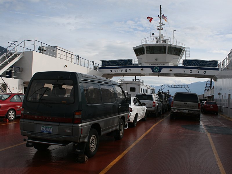
- Gumdrop aboard Osprey 2000
- Gumdrop aboard Osprey 2000.jpg (95.66 KiB) Viewed 4494 times
Gumdrop with Kootenay Lake and some mountains.
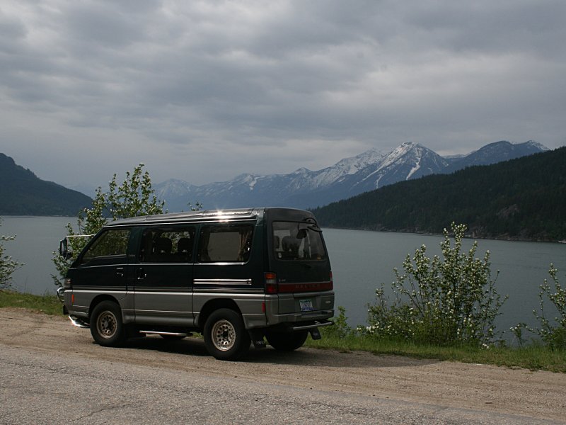
- Gumdrop and Kootenay Lake
- Gumdrop and Kootenay Lake.jpg (91.43 KiB) Viewed 4498 times
Gumdrop at the summit of Kootenay Pass.
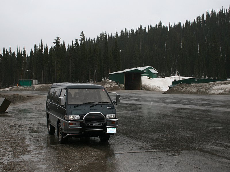
- Gumdrop in Kootenay Pass
- Kootenay Pass.jpg (111.69 KiB) Viewed 4487 times
The altimeter is much more interesting when you're driving in the mountains. The official elevation (confirmed with GPS) is 1774 meters. The Coquihalla summit is only about 1200 meters.
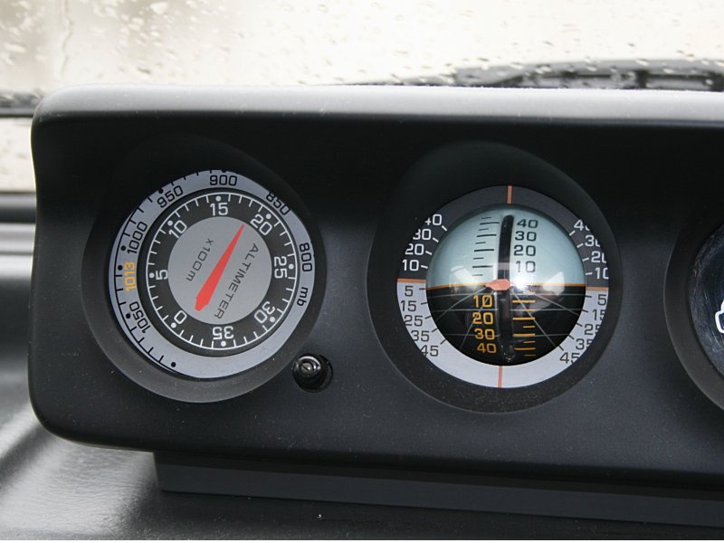
- Really high!
- Very high.jpg (78.41 KiB) Viewed 4478 times
...laura
Re: Gumdrop in the Kootenays
Posted: Thu May 22, 2008 11:54 pm
by FalcoColumbarius
Cool pictures Marsgal, I like the one by the lake ~ it has a beautiful light on the Gumdrop with the ominous clouds overhead. How did the mighty Gumdrop behave on the hills? Did you manage to remain in overdrive & c.?
Falco.
Re: Gumdrop in the Kootenays
Posted: Fri May 23, 2008 7:42 am
by mararmeisto
Well, at least you didn't have to pay overheight charges on THAT ferry... did you?
Re: Gumdrop in the Kootenays
Posted: Fri May 23, 2008 10:28 am
by marsgal42
We all know that Delica driving is a somewhat leisurely experience, and this trip was no exception. My minimum speed on the longest grades was about 70 klicks. This included the Coquihalla, the grades on the way up Kootenay Pass, and the surprisingly long and steep grades on the way in to Castlegar.
Coming in to Osoyoos from the east was entertaining, with a series of 20 km/h switchbacks coming down the hill, not unlike Duffey Lake. I was coming down them, so I disabled the overdrive and crept down like a semi-trailer driver. I also came down the long grade from Allison Pass in to Hope, though later in the summer I'll be grinding back up it.
The inland ferries don't cost a dime, though all but a couple are little more than barges. The coffee wasn't bad either. Here's the information about them
http://www.th.gov.bc.ca/marine/ferry_schedules.htm. I rode
Osprey 2000 across Kootenay Lake, and
Galena across Upper Arrow Lake.
...laura
Re: Gumdrop in the Kootenays
Posted: Fri May 23, 2008 11:15 am
by mararmeisto
I still remember taking the cable ferry across some ditch-with-water-running-through-it near Lillooet or Lytton - that was fun. Want to do it again some time, but I can't remember where it was! Will look at the schedule and see if I can figure it out. Then I gotta go on a road trip!
Re: Gumdrop in the Kootenays
Posted: Fri May 23, 2008 4:36 pm
by marsgal42
One final datum from the trip, after hitting the gas station this afternoon: 10.3 litres/100 km. This is about what I usually get on the highway.
...laura
Re: Gumdrop in the Kootenays
Posted: Fri May 23, 2008 6:34 pm
by jrman
Ok...that is quite funny....I'm pretty sure the "ditch with water in it" was the Fraser River at Lytton!!!! That's the only cable ferry I know of in the area.
A good road trip is to cross over to the West side of the Fraser at Boston Bar and head North - take a nice break at the Nehatlatch Valley and check out some of the great camping sites there (used to service the campsites as PR when I was an employee of the local lumber company of the day back in the 1980's). Then continue North passed some neat old homesteads that have been around for 100 years or more. On a lazy day when we probably should have been timber cruising or laying out cutblocks - we found the coolest cemetary - about 20 people, most from the same family, dating back to the late 1800's I think - well, very very old anyway by my standards - just like the creepiest movie set you've ever seen - partially grown over and some quite big headstones too. In a reasonably short distance, you'll pass from the Wet Coastal rainforest into the semi arid interior Ponderosa Pine belt before coming to the cable ferry - lots of great scenery along the way. The road follows the Powerline Right of Way for the most part. If you're not in a rush - you can do some great hiking in the Stein Valley while you're there. Only word of warning is that I haven't driven it myself in about 12 years - so no idea of the condition now. Would not recommend it in a car - but the deli would be more than fine assuming the road is still maintained to the standard I recall.
Re: Gumdrop in the Kootenays
Posted: Wed May 28, 2008 8:36 am
by konadog
Love the road-trip stories and pictures. Sounds like you had a fun drive. I like the Needles ferry (Cable? I think...) and then up past Burton and through Nakusp. Some good hotsprings up that way as well as some cool old backcountry mining roads too. Some of them go really high into the mtns. And if your look hard enough you can even find old mines... How lucky are we to have all these great roads to drive? Neil Young's "Freedom" often runs through my mind on road-trips - "Got fuel to burn, got roads to drive - keep on rockin' in the free world!!"

