My original plan was Rogers Pass then down to Cranbrook, but the mudslide out of Golden made that impossible. So I drove south from Revelstoke, took the ferry across Upper Arrow Lake, and headed for Nelson. I continued on around Kootenay Lake, taking MV Osprey 2000 across the lake. Neat trip. Neat boat. Pretty country.
The weather rapidly turned hideous, so I didn't linger. Here are some GPS fixes suitable for Google Earth (a first for me: please let me know if there are any issues), and I'll upload some pictures later. It was 9 and raining at the summit of Kootenay Pass, elevation 1774 meters. That road makes the Coquihalla look like a walk in the park. The altimeter is a much more interesting gauge when you're driving in mountainous country...
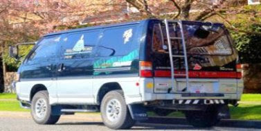
I didn't see any Delicas en route, but saw a couple of JDM Land Cruisers and a Lite Ace in Nelson, and a Soarer that passed me in Manning Park. Then I passed them getting a ticket just out of Hope. That long grade right at the junction of Highways 3 and 5.
...laura
 Good Ship