Travel the Coquihalla for FREE! (Pics and directions)

Topics may eventually be moved to other Delica Canada forums.

Moderators: BCDelica, mark

Post Reply
User avatar
The Pinkfingers
Posts: 483
Joined: Sat Apr 12, 2008 9:55 pm
Member's Photo Album: http://www.delica.ca/Photos/
Vehicle: '94 Exceed
Location: North Van, BC

Travel the Coquihalla for FREE! (Pics and directions)

Post by The Pinkfingers »

Our Delica earned her stripes (literally) this past week on our trip to the BC interior. Because of it, we were able to travel the Coquihalla for free. A little bit of 4x4 (and no snow) and a little bit of extra time is all you need. Pictures below.

Heading north (Hope to Merritt):

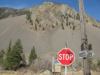
Take exit 221 (Falls Lake Road) and go back under the hwy. Follow the road to the parking lot and keep driving straight through onto the dirt "road". The highway exit is at N 49° 36.811' W 121° 02.938'

Keep driving...

You will eventually end up at exit 228 (Coquihalla Lakes Road), on the other side of the toll booth. :-) N 49° 39.597' W 121° 00.650'

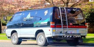
You will drive a fairly off-road route (at times). There is a "road" to follow that near the end joins a good gravel road. But it's bumpy! We came shortly after some rains, so lots of big ruts and wash outs. My five year old kept asking, "Are we going to fall off the cliff?" But it's quite safe, if you are a safe driver. The Jammy Dodger did excellent. Took us about 30 minutes to traverse the route.

WARNING - close tree branches adorn parts of the route, and the Jammy Dodger got her stripes - lots of them nose to tail - that will have to be buffed out. I'll be a little more careful next time. :oops:

You will pass near these waypoints:
N 49° 36.601' W 121° 03.336 (near Falls Lake Road)
N 49° 37.409' W 121° 03.388' (off road)
N 49° 39.236' W 121° 01.154' (near Coquihalla Lakes Road)

Heading south, obviously reverse the directions. :roll:

Some pictures of the nicer parts of our short adventure:
Hmm, I wonder what will happen of we drive down this road?
IMG_2450.JPG (69.74 KiB) Viewed 4193 times
And the road goes ever on... (any Tolkien fans?)
IMG_2453.JPG (74.03 KiB) Viewed 4194 times
A glimpse of where we've gone.  That's the road waaaay back there.
A glimpse of where we've gone. That's the road waaaay back there.
IMG_2454.JPG (73.1 KiB) Viewed 4194 times
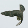
Hello!
Hello!
IMG_2455.JPG (126.79 KiB) Viewed 4188 times
Some wild flowers that line parts of the route
IMG_2459.JPG (145.97 KiB) Viewed 4191 times
More wild flowers
More wild flowers
IMG_2460.JPG (88.26 KiB) Viewed 4192 times
A view over the valley from our window (dumb camera focused on the wrong object)
IMG_2465.JPG (100.34 KiB) Viewed 4191 times
I can only add seven pics per post, so next post will have the rest.
Last edited by The Pinkfingers on Sat Aug 09, 2008 8:36 pm, edited 2 times in total.
User avatar
The Pinkfingers
Posts: 483
Joined: Sat Apr 12, 2008 9:55 pm
Member's Photo Album: http://www.delica.ca/Photos/
Vehicle: '94 Exceed
Location: North Van, BC

Re: Travel the Coquihalla for FREE! (Pics)

Post by The Pinkfingers »

OK - last part of the journey:
Road getting rocky, tree starting to close in.  Hmmm, do I choose ruts or trees.
Road getting rocky, tree starting to close in. Hmmm, do I choose ruts or trees.
IMG_2468.JPG (84.42 KiB) Viewed 4189 times
Someone decided to "plant" this in the middle of the road.
IMG_2473.JPG (71.77 KiB) Viewed 4188 times
Ouch.  Anyone have some car wax?
Ouch. Anyone have some car wax?
IMG_2475.JPG (69.42 KiB) Viewed 4188 times
30 minutes ago this was spotless.
IMG_2474.JPG (99 KiB) Viewed 4187 times
User avatar
mriguy
Posts: 72
Joined: Wed Apr 30, 2008 10:08 pm
Member's Photo Album: http://www.delica.ca/Photos/
Vehicle: 91 chameleon exceed
Location: Victoria AND Vancouver (I commute)

Re: Travel the Coquihalla for FREE! (Pics and directions)

Post by mriguy »

excellent! no more toll!--heading north anyways, right? this is the way to avoid the toll booth heading north, is there a work-around heading south???
User avatar
The Pinkfingers
Posts: 483
Joined: Sat Apr 12, 2008 9:55 pm
Member's Photo Album: http://www.delica.ca/Photos/
Vehicle: '94 Exceed
Location: North Van, BC

Re: Travel the Coquihalla for FREE! (Pics and directions)

Post by The Pinkfingers »

mriguy wrote:excellent! no more toll!--heading north anyways, right? this is the way to avoid the toll booth heading north, is there a work-around heading south???
Yep. Heading north goes exit 221 to 228. Heading south go exit 228 to 221. Just follow the GPS to the midway point, because you'll have to turn off the nice gravel road onto the less traveled path.

I recommend going north for the first time - less likely to make a wrong turn and you'll see exactly where you need to go.

FYI - even though you save $10 in tolls, you'll spend it on car wax! :-P
Green1
Posts: 3257
Joined: Wed Jul 19, 2006 9:18 pm
Member's Photo Album: http://www.delica.ca/Photos/
Vehicle: 1994 L400 Royal Exceed PF8W
Location: Calgary Alberta Canada
Contact:

Re: Travel the Coquihalla for FREE! (Pics and directions)

Post by Green1 »

I have noticed that there seems to be a general secrecy to the route, it is mentioned many times in 4x4 circles, but people are quite hesitant to post the actual location/directions... (I spent quite a while searching the web to find it my first time!)

The route is easiest to follow northbound, but isn't that hard southbound either. (it's just one turn you have to find)
The route takes about 30 minutes or so to drive, and saves maybe 10 minutes of highway.

I tell ya though, they put the toll on the wrong road, the bypass is much more fun!
User avatar
marsgal42
Posts: 772
Joined: Fri Jul 20, 2007 3:05 pm
Member's Photo Album: http://www.delica.ca/Photos/
Vehicle: The Mighty Gumdrop
Location: Burnaby, B.C.

Re: Travel the Coquihalla for FREE! (Pics and directions)

Post by marsgal42 »

If you look in your handy dandy BC Back Road Map Book you will see that the bypass route is perfectly clear on Chart 16 in the Vancouver, Coast & Mountains book. The Thompson Okanagan book (chart 6) does not show any roads at all at exit 221. Curious.

You can also follow the route in Google Earth. I can see how it would be a lot easier to find your way northbound.

While you don't need a 4x4 to get there, the Coquihalla Lakes Lodge is a nice place. I've stayed there.

...laura
User avatar
The Pinkfingers
Posts: 483
Joined: Sat Apr 12, 2008 9:55 pm
Member's Photo Album: http://www.delica.ca/Photos/
Vehicle: '94 Exceed
Location: North Van, BC

Re: Travel the Coquihalla for FREE! (Pics and directions)

Post by The Pinkfingers »

marsgal42 wrote:You can also follow the route in Google Earth.

...laura
Right on. We actually checked it out on Google Maps. Use the satellite tab and the road is quite visible.
User avatar
konadog
Posts: 1815
Joined: Tue Feb 26, 2008 9:25 pm
Vehicle: 1992 GLX L-300
Location: Campbell River, BC

Re: Travel the Coquihalla for FREE! (Pics and directions)

Post by konadog »

Looks like a great run. The stripes are awesome - a sign Jammy Dodger is getting out on the kind of adventuresome trips it was made for! Good stuff.
Image
Happy Day!
User avatar
FalcoColumbarius
Site Admin
Posts: 5983
Joined: Tue Jan 22, 2008 1:55 pm
Member's Photo Album: http://www.delica.ca/Photos/index.php?cat=11103
Vehicle: Delica; Chamonix GLX ('92 P25W)
Location: North Van, BC, eh?

Re: Travel the Coquihalla for FREE! (Pics and directions)

Post by FalcoColumbarius »

Cool post Pink,

Call me if you want wax advice for your paint job.

Falco.
Sent from my smart pad, using a pen.

Seek Beauty... Image Good Ship Miss Lil' Bitchi

...... Vision without action is a daydream. Action without vision is a nightmare. ~ Japanese Proverb
tomanique
Posts: 115
Joined: Fri Jul 20, 2007 7:01 pm
Member's Photo Album: http://www.delica.ca/Photos/
Vehicle: FRANKENDELI-92 Green/Grey Super-X
Location: Chilliwack
Contact:

Re: Travel the Coquihalla for FREE! (Pics and directions)

Post by tomanique »

Now that our rum-loving premier has scrapped the tolls on the Coquihalla this thread may no longer hold it's value. Maybe we could redirect the topic on ways to bypass the upcoming tolls on the Port Mann. :idea: Snorkels anyone? :wink: :wink: :wink:

Cheers
Tom
Yarrrrp.
Image
Green1
Posts: 3257
Joined: Wed Jul 19, 2006 9:18 pm
Member's Photo Album: http://www.delica.ca/Photos/
Vehicle: 1994 L400 Royal Exceed PF8W
Location: Calgary Alberta Canada
Contact:

Re: Travel the Coquihalla for FREE! (Pics and directions)

Post by Green1 »

Now that our rum-loving premier has scrapped the tolls on the Coquihalla this thread may no longer hold it's value
This is the first I've heard of this... though it is good news if true!

however as for the value... it is still an interesting route, and there are lots of great spots to camp along it, plus, I always said they put the toll on the wrong road, the bypass is far more fun!
User avatar
rdub
Posts: 261
Joined: Wed May 23, 2007 7:18 pm
Member's Photo Album: http://www.delica.ca/Photos/
Location: aldergrove

Re: Travel the Coquihalla for FREE! (Pics and directions)

Post by rdub »

scratches are good. :-D
I am stable in most situations that I have no reservations in stormy conditions.
Post Reply

Return to “General Discussion”