Heading up with the spouse and child this weekend. We are crashing at my folks' little place up there. I was wondering about the east side of the lake. Is there a beach or something worth driving to on that side of the lake that isn't too far? I have a 20 month old daughter, so I don't want to be bouncing around for too long. I'm hoping to find a little beach or something where she can frolic freely as happy child should while daddy gets to dirty-up the delica a little.
Thoughts?
harrison july 16th
Moderator: mark
-
bassnailer
- Posts: 306
- Joined: Mon Jun 09, 2008 7:53 pm
- Member's Photo Album: http://www.delica.ca/Photos/
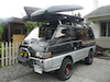
- Vehicle: '92 L300 Super Duper Exceed
- Location: Vancouver
- Location: Vancouver
harrison july 16th
Last edited by bassnailer on Tue Jul 12, 2011 6:38 am, edited 1 time in total.
-
nxski
- Posts: 3268
- Joined: Tue Aug 31, 2010 6:27 pm
- Member's Photo Album: http://www.delica.ca/Photos/
- Vehicle: 1991 Delica L300 Super Exceed
- Location: Coquitlam
- Location: BC, Canada
- Contact:
Re: harrison july 16th
The 'bouncy' parts are on the Harrisson side of the trail. If you head up towards Pemberton there are lots of Hotsprings you could go to. As for beaches, I'm sure you could get out to the lakeside somehow. Do you have the backroads maps for that area?
Live the life you love, love the life you live...
Had: 1991 Mitsubishi Delica L300 SuperExceed, heavily modified (totalled by a drunk driver)
Have: 2011 Acura CSX manual, lightly modified
Want: Mitsubishi Pajero Evo
http://nes-design-construction.com
http://ca.linkedin.com/pub/nicolas-spurling/46/b48/924
Nicola Spurling
Had: 1991 Mitsubishi Delica L300 SuperExceed, heavily modified (totalled by a drunk driver)
Have: 2011 Acura CSX manual, lightly modified
Want: Mitsubishi Pajero Evo
http://nes-design-construction.com
http://ca.linkedin.com/pub/nicolas-spurling/46/b48/924
Nicola Spurling
-
FalcoColumbarius
- Site Admin
- Posts: 5983
- Joined: Tue Jan 22, 2008 1:55 pm
- Member's Photo Album: http://www.delica.ca/Photos/index.php?cat=11103
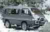
- Vehicle: Delica; Chamonix GLX ('92 P25W)
- Location: North Van, BC, eh?
Re: harrison july 16th
20 Mile Bay. Or where the road itself comes down to the lake north of 20 Mile Bay is a nice place to stop and explore or make tea, &c..
Give me a call if you like, we can hook up for coffee and I'll show you on the map.
Falco.
Give me a call if you like, we can hook up for coffee and I'll show you on the map.
Falco.
Sent from my smart pad, using a pen.
Seek Beauty...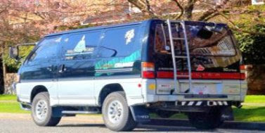 Good Ship Miss Lil' Bitchi
...... Vision without action is a daydream. Action without vision is a nightmare. ~ Japanese Proverb
Seek Beauty...
Good Ship Miss Lil' Bitchi...... Vision without action is a daydream. Action without vision is a nightmare. ~ Japanese Proverb
-
bassnailer
- Posts: 306
- Joined: Mon Jun 09, 2008 7:53 pm
- Member's Photo Album: http://www.delica.ca/Photos/
- Vehicle: '92 L300 Super Duper Exceed
- Location: Vancouver
- Location: Vancouver
Re: harrison july 16th
Oh Brother. I meant to say the East side of the lake, not the west side. I edited my original post to reflect this change,
-
TardisDeli
- Posts: 1425
- Joined: Tue Sep 18, 2007 10:57 pm
- Member's Photo Album: http://www.delica.ca/Photos/
- Vehicle: 1991 L300. 1997 L300.
- Location: Burnaby
- Location: Burnaby, Gaglardi freeway exit
- Contact:
Re: harrison july 16th
Hi Enzo,
East side road is much smoother gravel than west side, can easily be done by 2WD cars... its wider (2 or 3 lanes wide in places), flat, BUT The east side is more dangerous becuz of the stupid drunken young guys driving in overly lifted trucks or in beat up cars (the road is 2 wheel drive OK till Bear Creek). No pretty beaches once you leave the houses area, as the road follows the cliffs and lake edge. A destination for you might be the Foresty campsite named Bear Creek Recreation (on left just past the big waterfall which you see on your right as you drive over the bridge) (is BEFORE Bear Creek on the map) was very nice, down a steep little road into a little wooded camping area, usually has a resident host to collect fees. We used to camp there till I got disgusted with the local teenagers violence at night. Some miles After that is the huge flat bay at Bear Creek, very shallow from the silt outflow, you see lotsa people standing in water up to their knees, but they are about 20 yards from shore, looks pretty but dont go barefoot due to broken beer bottles etc. Windsurfers usually end their uplake run there, and turn around to surf back to town. Usually a very strong afternoon wind. After that the road gets skinny, and heads inland (yes there is an odd and filthy hot springs way up a steep 4wdLow road, in homemade old wooden tubs, warm water in winter, probably seething with disease in summer) nice scenery last Easter in the snow when we did it, but hard to navigate with the idiots driving towards you who don't understand road politeness. Hmmm, rereading this it sounds kinda negative...but sadly it is all true, we used to go there many times, then we got a Delica and discovered the west side. It might be better midweek if those idiots have jobs. Just allow yourself plenty of time, take lots of water, full fuel tanks (the road is longer than one thinks, its a huge lake) and don't leave your vehicle alone in case idiots target practise. I think the West side is better becuz the rough 4WD drive keeps some idiots out.
By the way, on the smooth gravel roads, you may not need your 4WD, but if it is potholey, then using 4WD smooths out the ride for the passengers and their bouncing necks.
Do you have the Backroads map book, it shows it very well. I used to calculate that I drove that road at an average of 25 km per hour, including pauses to pull over to let LONG logging trucks past.
There is a day picnic area at the start of the road, (I think its still paved, just past the last houses) the name has Green in the title I think. Big parking area, launch ramp, grass, clean, etc.
A good local resource is the poeple at the launch ramp in town, just before you get onto the west road. I dont know about any washouts on the road, after the huge snowpack we had.
Christine.
Christine
Of The TardisDeli My TardisDeli travels thru time and space. Our house is nicknamed the TardisDeli Motel, as so many delii owners visit to share delii stories.
Of The TardisDeli My TardisDeli travels thru time and space. Our house is nicknamed the TardisDeli Motel, as so many delii owners visit to share delii stories.
-
bassnailer
- Posts: 306
- Joined: Mon Jun 09, 2008 7:53 pm
- Member's Photo Album: http://www.delica.ca/Photos/
- Vehicle: '92 L300 Super Duper Exceed
- Location: Vancouver
- Location: Vancouver
Re: harrison july 16th
Thanks for reply guys. Good to hear from you. Haven't had a chance to make the meets lately and catch-up. Anyway, I think we'll just spend most of the time at Hicks Lake and skip the trip down road. I have heard similar things about the east side of the lake. Not into that kinda thing. Lake-side sounds like a nice option. Hopefully I'll catch a fish.
Re: harrison july 16th
We're going camping this wknd. This sounds like a good spot. Contact me!
Richard Dagenais
-
sasquatch-hunter

- Posts: 620
- Joined: Sat Sep 01, 2007 8:56 am
- Member's Photo Album: http://www.delica.ca/Photos/
- Vehicle: 2 Delica
- Location: Quesnel BC
- Location: Quesnel BC
- Contact:
Re: harrison july 16th
East side has a nice beach just off the logging camp at Silver Creek. Watch out for grizzlies, as my friend saw one on Hornet Creek.
-
bassnailer
- Posts: 306
- Joined: Mon Jun 09, 2008 7:53 pm
- Member's Photo Album: http://www.delica.ca/Photos/
- Vehicle: '92 L300 Super Duper Exceed
- Location: Vancouver
- Location: Vancouver
Re: harrison july 16th
I never had the chance to get back online before we left, or I would have contacted you, RichD, had I seen your post. Thanks for everyones help. I have another question, but I'll start another post.